
Pentax K-1 II + DFA 28-105mm F3.5-5.6 + CP
28 mm ISO 100 for 1/40 sec. at ƒ/8.0
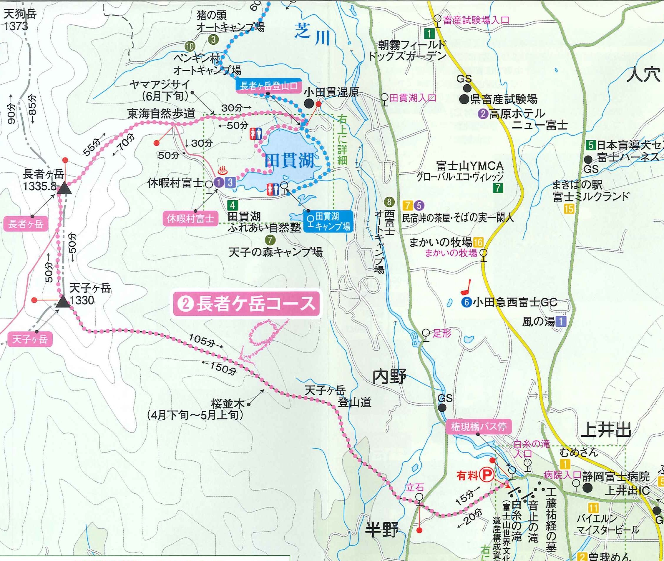
From Lake Tanuki to Mountain Peaks: Exploring the Chojagatake Range
Location: Lake Tanuki, Shizuoka, Japan
Timestamp: 09:24・2024/02/28
From the northeastern shore of Lake Tanuki, a panoramic view of the Chojagatake Mountain Range unfolds before us. This range forms the western ridge of a basin that stretches from Chojagatake in the west to Mount Fuji in the east.
The basin encompasses the charming city of Fujinomiya, which boasts a few golf courses and camping sites but primarily consists of vast stretches of farmland and tree plantations. Many of Fujinomiya's farms are irrigated with the waters of Lake Tanuki, as depicted in the accompanying photo.
At an elevation of 1,336 meters (4,383 feet), Mt. Chojagatake hosts a popular hiking trail, offering adventurers the opportunity to enjoy breathtaking vistas of Mount Fuji's western flank. This 10-kilometer (6.2 mi) trail meanders from the shores of Lake Tanuki southward to the summit of Mount Tenshigatake, a journey typically taking about 5 hours to complete.
Although it's feasible to hike the trail in a single day, it presents significant challenges. With steep ascents totaling around 654.7 meters (2,148 feet) in elevation gain, the trail earns its classification as "challenging." It's ideally suited for seasoned hikers equipped with proper hiking gear, adept at reading topographic maps, and eager for an adventurous experience.
References:
- Google Maps: Lake Tanuki (田貫湖)
- Google Maps: Chojagatake Mountains (長者ヶ岳)
- Lake Tanuki (English)
- Fujinomiya City: Hiking Trail Chojagatake to Tenshigatake (Japanese)
- Yamap: Hiking Trail Chojagatake to Tenshigatake (Japanese)
- All Trails: Lake Tanuki - Mount Chojagatake (English)
- Yamanashi Prefecture: Climbing Difficulty Rankings (English)
Copyright Notice for All Images:
© 2011-2024 Pix4Japan. All rights reserved.
Unauthorized use for AI training is strictly prohibited.
Visit www.pix4japan.com for prints and licensed download options.
No comments:
Post a Comment