2024-07-17

Miyagase Dam

Miyagase Dam・宮ヶ瀬ダム
Fujifilm X100V with 5% diffusion filter
ISO 160 for 1/500 sec. at ƒ/3.2
Velvia/Vivid film simulation

Shin-Ishigoyabashi Bridge・新石小屋橋
Fujifilm X100V with 5% diffusion filter
ISO 320 for 1/420 sec. at ƒ/2.8
Velvia/Vivid film simulation

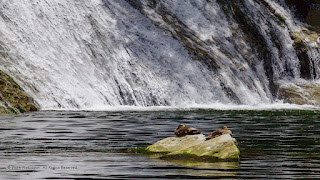
Miyagase Dam Spillway・宮ヶ瀬ダムの放水路
Fujifilm X100V with 5% diffusion filter
ISO 320 for 1/680 sec. at ƒ/3.6
Velvia/Vivid film simulation

Nestled about 60 km west of Tokyo, the Miyagase Dam offers a nice blend of natural beauty and engineering feat. Just a two-hour drive via the Chuo or Tomei Expressways, this impressive structure is easily accessible from the bustling cities of Tokyo and Yokohama. Located in the town of Aikawa, Kanagawa Prefecture, the dam has convenient parking at several lots within walking distance of the dam, with parking fees starting at a modest ¥500.

This was my first visit to the dam, but my fifth visit to the Lake Miyagase area. I fondly recall my first visit to the area in the early '90s when I would drive my Nissan Silvia (RS-X/S12) along the winding roads of Kiyokawa and Tsukui villages. Back then, residents were being relocated to make way for the dam, which eventually submerged several villages beneath the deep waters of Lake Miyagase, which was finally formed in 1998. This visit, however, wasn't for a photo shoot but a nostalgic reunion with old friends from the '80s.

Miyagase Dam provides ample resources in English and other languages, enhancing accessibility for international tourists. For detailed maps and references, please see the links below:

Copyright Notice for All Images:
© 2011-2024 Pix4Japan. All rights reserved.
Unauthorized use for AI training is strictly prohibited.
Visit www.pix4japan.com for prints and licensed download options.


2024-07-10

Kazusa-Nakano Station

Download a licensed digital photo: pix4japan.picfair.com
Order a print: pix4japan.smugmug.com

The Nostalgic Charm of Kazusa-Nakano Station

Location: Otaki Town, Chiba Prefecture, Japan
Timestamp: 13:50・2024/07/10

Fujifilm X100V with 5% diffusion filter
ISO 640 for 1/250 sec. at ƒ/2
Provia/Standard film simulation

On my journey home from Katsuura along Chiba’s Pacific coastline, I headed inland and stumbled upon a hidden gem—Kazusa-Nakano Station. This quaint little train station instantly transported me back in time with its unmistakable Showa-era charm, a relic of a simpler, quieter Japan when I was much younger. Serving both the Isumi Line and Kominato Line, this station feels like a nostalgic postcard from the past.

Kazusa-Nakano Station, with its single platform, seems almost suspended in time. One side of the platform is for the Isumi Line, while the other side welcomes the Kominato Line. The station remains unstaffed, enhancing its tranquil and somewhat remote atmosphere. Here, there are no bustling ticket gates, loud announcements—just the hum of a diesel train waiting for departure. Be sure to carry exact change for your fare, or plan ahead and purchase tickets at the terminus, Ohara Station.

Originally constructed in 1928 and rebuilt in 1989, the station has retained its old-world charm. The analog clock above the entrance is a delightful reminder of days gone by, ticking away in harmony with the slow pace of life here. The hand-carved station sign is weathered by time with parts of the lettering preserved by the warmth of nearby lamps.

Inside, where my border collie found a peaceful spot to rest, the station offers a few simple amenities—a collection of pamphlets for curious tourists, a timetable for planning unhurried journeys, and a large notebook brimming with anonymous messages. These notes capture the thoughts and feelings of visitors, whether they’re reflecting on the quiet beauty of the station, the gentle ride along the Isumi Line, or their adventures in the local area.

In the background, a single-car train of the Isumi Line waits patiently for its next departure. The schedule is leisurely, with trains arriving about once an hour. There are even moments when the station falls silent for up to 90 minutes, allowing you to pause and savor the tranquility of your surroundings.

References:

Copyright Notice for All Images:
© 2011-2024 Pix4Japan. All rights reserved.
Unauthorized use for AI training is strictly prohibited.
Visit www.pix4japan.com for prints and licensed download options.


Carriage 351

Download a licensed digital photo: pix4japan.picfair.com
Order a print: pix4japan.smugmug.com

Nostalgic Encounter with an Isumi Line Carriage・昭和レトロの旅:上総中野駅といすみ線の350型の黄色い一両列車

Location: Otaki Town, Chiba Prefecture, Japan
Timestamp: 13:48・2024/07/10

Fujifilm X100V with 5% diffusion filter
ISO 320 for 1/320 sec. at ƒ/2.2
Pro Negative High film simulation

While exploring the quaint Kazusa-Nakano Station, I was delighted to experience the charm of an old train station that has a Showa-era vibe. To my surprise, a single yellow carriage of the Isumi Line rolled gently into the station, its vibrant colors contrasting beautifully against the lush green backdrop.

Intrigued, I wandered behind the station for a closer look at the train that had just arrived. This particular train is an Izumi Model 350, a diesel railcar series introduced to the Isumi Line in 2013 and 2014. In the photo, we can see carriage No. 351, one of only four carriages on the entire line. The other carriages are Nos. 301, 302, and 352.

The Isumi Line’s fleet of only 4 carriages is thoughtfully designed to cater to both commuters and tourists. Two of the carriages feature long, bench-style seating that runs parallel to the length of the carriage—perfect for the bustling weekday commute. The other two carriages are fitted with cross-seating, where groups of four seats face each other, providing a more intimate setting ideal for leisurely weekend rides. These cross-seating carriages offer tourists a panoramic view of the picturesque countryside as they journey through the rural countryside.

The 350 Series is a modern iteration inspired by the classic Kiha 52 series, first introduced to Japanese railways in 1958. These diesel railcars are powered by a robust in-line 6-cylinder, 355 PS diesel engine, with a transmission that combines one gear and two direct gears, offering a smooth ride and efficient operations.

As I stood there, listening to the hum of the idling diesel engine, memories of my first ride on a single carriage diesel train came flooding back. It was on the Sagami Line in the 1980s, an experience that left a lasting impression on me as most other trains I rode were all electrified. The low rumble of the diesel engine reminded me of driving a diesel farm tractor on my father’s farm—a sound both comforting and evocative. I hope to relive that experience one day, perhaps on this very train, when I have a chance to secure a sitter for my border collie.

References:

Copyright Notice for All Images:
© 2011-2024 Pix4Japan. All rights reserved.
Unauthorized use for AI training is strictly prohibited.
Visit www.pix4japan.com for prints and licensed download options.


Karugamo Ducks

Download a licensed digital photo: pix4japan.picfair.com
Order a print: pix4japan.smugmug.com

Sunlit Karugamo Ducks and Shimmering Falls ・カルガモと一緒に、粟又の滝を満喫

Location: Otaki Town, Chiba Prefecture, Japan
Timestamp: 12:59・2024/07/10

Pentax K-1 II + DFA 28-105mm F3.5-5.6 + CP
105 mm ISO 100 for 1/800 sec. at ƒ/9

During my visit to Awamata Falls on the Yoro River, I was delighted to see several families with young children and toddlers playing in the cool, shallow waters. This heartwarming sight brought back memories of my own childhood, spent exploring the soothing creeks and streams that meandered through narrow valleys in the mountains.

Alongside these families, some waterfowl rested peacefully on the river's shoreline, unfazed by the humans enjoying the water. Among them was a pair of Eastern Spot-billed Ducks (Anas zonorhyncha), basking in the warm summer sun on small stone islands in the middle of the river.

Eastern Spot-billed Ducks are a common sight throughout most of Japan. They thrive in diverse habitats such as lakes, marshes, wetlands, rice fields, tidal flats, and rivers. These ducks are year-round residents in the southern half of Japan’s main island, Honshu.

Given that their breeding season spans from mid-June to early August, I suspect this pair is a male and female. I would love to return in late August to see if there are any ducklings along the shores of the Yoro River waiting to be photographed!

References:

Copyright Notice for All Images:
© 2011-2024 Pix4Japan. All rights reserved.
Unauthorized use for AI training is strictly prohibited.
Visit www.pix4japan.com for prints and licensed download options.


Awamata Falls, Chiba

Download a licensed digital photo: pix4japan.picfair.com
Order a print: pix4japan.smugmug.com

Awamata Falls: Enjoy Meditation and Forest Bathing・粟又の滝:森林浴が楽しめるパワースポット

Location: Otaki Town, Chiba Prefecture, Japan
Timestamp: 12:37・2024/07/10

Pentax K-1 II + DFA 28-105mm F3.5-5.6 + CP + 10-stop ND filter 
45 mm ISO 200 for 2.0 sec. at ƒ/8

Downstream from Awamata Falls, the effects of Typhoon Yun-yeung (#13), which struck on September 8, 2023, are still evident. The area is strewn with wood debris and large boulders, and parts of the promenade that once lined the shoreline are missing.

Despite the current condition of the Yōrō River (養老川, Yōrōgawa) downstream, the waterfall is considered the most famous in the Yoro Valley of Chiba’s Boso area, as noted by the local municipality. It flows gracefully down a 100-meter rock face, resembling a natural waterslide and creating a picturesque scene perfect for landscape photography.

At the base of the falls lies a shallow pond, extending into a stream that is popular during summer. Young families flock here, seeking a safe environment for children to play and interact with nature.

Promotional materials from the Chiba Prefectural Government, the Chiba Prefectural Tourism & Local Products Association, and Otaki Town encourage visits in autumn. As temperatures drop to a more comfortable level, the valley transforms into a vibrant tapestry of reds, oranges, and yellows, typically peaking from November to early December. Otaki Town proudly touts this foliage spectacle as one of Chiba Prefecture's finest.

For those traveling by car, parking at the hotel across from the trailhead to the falls costs only 500 yen. The Tourism Division of Otaki Town reminds visitors to pack out their trash and note that barbecues are prohibited in Yoro Valley and surrounding areas. Please follow the "Leave No Trace" principles and be mindful of your surroundings, mirroring the behavior of local families.

At the end of your visit, consider supporting the local businesses near the trailhead. These establishments rely on the patronage of visitors and guests from the nearby hotel.

Shop ①: Yama Neko (里のジェラテリア 山猫)

This upscale shop offers drinks, gelato, and ice cream. Its stylish, modern interior is reminiscent of high-end spots in central Tokyo and the Yokohama MM21 waterfront.

Shop ②: Takinoya (滝乃家)

A quaint mom-and-pop teahouse, Takinoya sells groceries, cold drinks, and a variety of soft ice cream flavors. During winter, they serve hot amazake to warm you up. The charming elderly owner is a delight to converse with if you speak Japanese. The shop exudes a nostalgic Showa era vibe, offering a timeless experience that resonates with older visitors like myself.

References:

Copyright Notice for All Images:
© 2011-2024 Pix4Japan. All rights reserved.
Unauthorized use for AI training is strictly prohibited.
Visit www.pix4japan.com for prints and licensed download options.


Ubara Beach, Chiba

Download a licensed digital photo: pix4japan.picfair.com
Order a print: pix4japan.smugmug.com

Ubara Beach: Chiba’s Secluded Gem Off the Pacific Coast

Location: Ubara Beach, Chiba Prefecture, Japan
Timestamp: 10:51・2024/07/10

Pentax K-1 II + DFA 28-105mm F3.5-5.6 + CP + 10-stop ND filter 
34 mm ISO 100 for 3.0 sec. at ƒ/11

I love the contrast of the light-colored sand on Ubara Beach with the darker tones of turquoise waters that lazily flow into the cove off the eastern coast of Chiba Prefecture.

Located approximately 100 km southeast of Tokyo, or about a 2-hour drive, Ubara Beach was nearly abandoned when I arrived, with only a few locals relaxing in the shade of a beachside shack or on the porch of their old houses.

Ubara Beach is one of Chiba Prefecture's most scenic spots and has been selected as one of the "100 Best Beaches in Japan." Once summer vacation starts for Japanese schoolchildren, the beach attracts many more visitors from Tokyo and surrounding areas for swimming and sunbathing, making it a bustling hub of activity. Further down the shoreline, away from beachgoers, fishing is also a popular pastime.

Over the past 40 years, I have visited many Japanese beaches. Shirahama Beach on the Izu Peninsula remains my favorite outside the peak summer season. Ubara Beach is a close second favorite, thanks to its solitude and the moss-covered rocks that create interesting photographic foregrounds.

Unlike many more popular beaches with easy access from Tokyo, especially along Shonan Bay and the eastern coast of the Izu Peninsula, Ubara Beach is a bit more secluded. Out-of-town visitors would be wise to stock up on food and drinks as there are no convenience stores in the immediate area, and there are few shops or restaurants where you can buy meals or refreshments.

My conversations with a few of the locals revealed that they don’t really consider their beach to be a tourist destination, which would explain how the village has been able to maintain its at-home vibe, free of the noise and litter more commonly associated with areas overwhelmed with tourists.

However, there are several minpaku close to the beach where out-of-town visitors can stay for a night and enjoy a leisurely day or two getting a taste of life in a small Japanese fishing village. The beach is blessed with beauty and is free of the rowdy and noisy crowds more likely to show up at beaches in Kamakura, Enoshima, Kugenuma, and others along the shores of Shonan Bay.

Access to the beach was relatively easy. We parked at the Ubara Utopia Visitor Parking Lot, which is free. The trail from the parking lot takes you through an old hand-dug tunnel for pedestrian use, making it a mere 10-minute walk to the beach.

Whether you seek solitude or the perfect photograph, Ubara Beach offers a unique escape from the crowds. I highly recommend visiting this hidden gem to experience its natural beauty firsthand.


Copyright Notice for All Images:
© 2011-2024 Pix4Japan. All rights reserved.
Unauthorized use for AI training is strictly prohibited.
Visit www.pix4japan.com for prints and licensed download options.


Exploring Ubara's White Torii

Download a licensed digital photo: pix4japan.picfair.com
Order a print: pix4japan.smugmug.com

Location: Ubara Beach, Chiba Prefecture, Japan
Timestamp: 10:43・2024/07/10

Pentax K-1 II + DFA 28-105mm F3.5-5.6 + CP + 10-stop ND filter 
ISO 100 for 3.0 sec. at ƒ/11

Download a licensed digital photo: pix4japan.picfair.com
Order a print: pix4japan.smugmug.com

Location: Ubara Beach, Chiba Prefecture, Japan
Timestamp: 11:06・2024/07/10

Fujifilm X100V with 5% diffusion filter
ISO 160 for 1/1500 sec. at ƒ/6.4
Pro Negative High film simulation

The White Torii by the Sea: The Charm of Ubara Beach and Yasaka Shrine

Located on Ubara Beach, approximately 100 km southeast of Tokyo, or about a 2-hour drive, the torii gate of Yasaka Shrine is a striking landmark. Its white color harmonizes beautifully with the blue sky and turquoise ocean waters of the cove.

This torii gate is the first of two belonging to Yasaka Shrine. The second gate, a traditional vermilion torii, is situated about 500 meters further inland at the shrine's entrance.

Yasaka Shrine was founded in the latter half of the Kamakura period (1192–1333). It houses a guardian deity believed to ward off evil and is a branch shrine of the famous Yasaka Shrine in Kyoto.

Ubara Beach is one of Chiba Prefecture's most scenic spots and has been selected as one of the "100 Best Beaches in Japan." In summer, it attracts visitors from Tokyo and surrounding areas for swimming and sunbathing. The nearby coastal areas are also popular for fishing.

Every year on the seventh day of the sixth month of the lunar calendar, Yasaka Shrine hosts a festival featuring a portable shrine and a procession of feudal lords. This procession parades along the Ubara Coast, passing near the white torii gate.

Ubara Beach, home to the white torii, is a delightful place for beach activities, strolling, fishing, and even sea yoga.

References:

Copyright Notice for All Images:
© 2011-2024 Pix4Japan. All rights reserved.
Unauthorized use for AI training is strictly prohibited.
Visit www.pix4japan.com for prints and licensed download options.


Ubara Island

Download a licensed digital photo: pix4japan.picfair.com
Order a print: pix4japan.smugmug.com

Ubara Island: A Diver’s Underwater Utopia・楽園のダイビング: 鵜原島の水中の不思議を発見

Location: Katsuura, Chiba Prefecture, Japan
Timestamp: 09:49・2024/07/10

Pentax K-1 II + DFA 28-105mm F3.5-5.6 + CP + 10-stop ND filter 
73 mm ISO 100 for 3.0 sec. at ƒ/5.6

From the scenic vantage point at the end of the Ubara Utopia Trail, you can gaze out over the deep waters of the Pacific Ocean to the tiny Ubara Island. This idyllic spot off the coast of Myojin Cape is a popular destination for scuba divers and snorkelers alike.

Ubara Island offers a vibrant underwater world, teeming with diverse marine life nestled among its submerged cliffs and crevasses. The island’s unique topography creates a haven for an array of sea creatures, making every dive an exciting adventure.

Divers are treated to sights of half-lined cardinal fish, rockfish, and convict fish finding solace in their cozy crevices, while isaki (grunt), takabe (sardine), and horse mackerel dart energetically through the depths. The ledges of the underwater cliffs often host cat sharks, adding a thrilling element to the experience. Between winter and spring, you might also encounter lumberjacks and frogfish.

Whether you're a seasoned diver or new to the underwater world, Ubara Island offers a delightful blend of beauty and biodiversity that promises to captivate and inspire underwater adventurers.

References:

Copyright Notice for All Images:
© 2011-2024 Pix4Japan. All rights reserved.
Unauthorized use for AI training is strictly prohibited.
Visit www.pix4japan.com for prints and licensed download options.


Cape Kedo Sea Cliffs

Download a licensed digital photo: pix4japan.picfair.com
Order a print: pix4japan.smugmug.com

Cape Kedo: Remnants of Boshu Stone Quarries and Rich Geological History

Location: Kedoura Inlet, Chiba Prefecture, Japan
Timestamp: 9:22・2024/07/10

Pentax K-1 II + DFA 28-105mm F3.5-5.6 + CP + 10-stop ND filter 
ISO 100 for 3.0 sec. at ƒ/6.3

Cape Kedo, situated on the east coast of Chiba Prefecture facing the Pacific Ocean, showcases heavily eroded sea cliffs and remnants of quarried stone.

The exposed strata, dating back approximately 2.5 million years, are visible on the sea cliffs, revealing interlayers of sandstone, mudstone, turbidite, trace fossils, and various types of tuff (volcanic ash). Signs of ancient fault slips can also be seen up close on the cliff faces.

This coastal area, including Cape Kedo and numerous other capes along the Boso Peninsula, was once a bustling site of stone quarries. These quarries extracted stone from the Mineoka Ophiolite Belt, which extends from the Pacific coastline to Tokyo Bay.

The Mineoka Belt was formed by geological activity resulting from undersea volcanic activity, leading to the formation of large reservoirs of Boshu stone. This stone was ideal for crafting tombstones, stone lanterns, and large blocks used for building foundations and construction materials during the Edo Period (1603–1868).

Commodore Perry's arrival in 1853 highlighted the strategic importance of fortified coastal defenses, prompting the shogunate to source Boshu stone for artillery batteries.

In 1858, following the U.S.-Japanese Treaty of Amity and Commerce, the city of Yokohama was opened. This led to the rapid construction of foreign settlements and major port infrastructure using Boshu stone, including modern wharfs, customs structures, and piers.

Demand for Boshu stone continued to grow as Yokohama rapidly became an international port, facilitating the construction of Western-style stone buildings. Today, the cliffs of Cape Kedo stand as a testament to the region's rich geological history and its role in shaping Japan's coastal defenses and international trade.

Glossary:
  • 房総半島嶺岡帯 (Bōsōhantō Mineoka-tai): Boso Peninsula Mineoka belt
  • 鵜原・Ubara: coastal district in the city of Katsuura, Chiba Prefecture
  • 採石場 (saisekiba): quarry: 
  • 嶺岡構造帯 (Mineoka kōzō-tai): Mineoka Tectonic Zone
References:

Copyright Notice for All Images:
© 2011-2024 Pix4Japan. All rights reserved.
Unauthorized use for AI training is strictly prohibited.
Visit www.pix4japan.com for prints and licensed download options.


Kedoura Inlet

Download a licensed digital photo: pix4japan.picfair.com
Order a print: pix4japan.smugmug.com

Kedoura Inlet: A Scenic Escape in Chiba

Location: Kedoura Inlet, Chiba Prefecture, Japan
Timestamp: 9:20・2024/07/10

Pentax K-1 II + DFA 28-105mm F3.5-5.6 + CP
ISO 100 for 1/320 sec. at ƒ/5.0

The Kedoura Inlet on the eastern shore of Chiba Prefecture offers a stunning view of the Pacific Ocean, framed by eroded rock formations that reveal a glimpse into the geological history of Myojin Cape. This picturesque area is part of the Minami-Boso Quasi-National Park, which features numerous coves and cliffs that reach the water’s edge, their tops lush with trees, grass, and shrubbery.

Hiking trails extend for several kilometers throughout the park, leading to several scenic spots, including this small inlet. The trails offer a chance to explore the natural beauty and tranquility of the area, making it a perfect destination for nature enthusiasts and hikers.

During the Taisho period (1879–1926), there were ambitious plans to transform this area of Chiba Prefecture into a resort destination named Uhara Risōkyō (Ubara Utopia). However, these plans were aborted due to the devastating impact of the Great Kanto Earthquake on September 1, 1923. The earthquake resulted in the deaths of more than 110,000 individuals and left nearly 1.5 million people homeless, halting the development of the resort.

Despite this, the natural beauty and historical significance of the Kedoura Inlet and its surroundings continue to attract visitors, offering a unique blend of scenic landscapes and a poignant reminder of the region’s past.

References:

Copyright Notice for All Images:
© 2011-2024 Pix4Japan. All rights reserved.
Unauthorized use for AI training is strictly prohibited.
Visit www.pix4japan.com for prints and licensed download options.


Border Collie at Chiba Beach

Download a licensed digital photo: pix4japan.picfair.com
Order a print: pix4japan.smugmug.com


Cooling Down on Myojin Cape

Location: Myojin Cape, Chiba Prefecture, Japan
Timestamp: 9:15・2024/07/10

Pentax K-1 II + DFA 28-105mm F3.5-5.6 + CP
ISO 100 for 1/80 sec. at ƒ/9.0

Located on the southwestern coast of Chiba Prefecture, the Kedoura Inlet features a small beach with a mixture of sand and seashells where my border collie promptly found a small pool of cool water to rest in.

The inlet is part of the Ubara Utopia Hiking Trail, which leads to various outlook points on Myojin Cape. Here, you can enjoy grand views of the Pacific Ocean and feel the cool ocean breeze flowing inland from the chilly deep waters just off the coastline.

While heading down to the beach, I ran into an elderly local bird photographer on the trail. We struck up a conversation, and he ended up accompanying me to this beach. 

He shared many interesting details about the local bird population, flowering plants, and the various creatures living in and around the small pools of water and eroded rocks along the beach. I was very fortunate to meet someone so friendly and willing to share so much knowledge of the area!

References:


Copyright Notice for All Images:
© 2011-2024 Pix4Japan. All rights reserved.
Unauthorized use for AI training is strictly prohibited.
Visit www.pix4japan.com for prints and licensed download options.